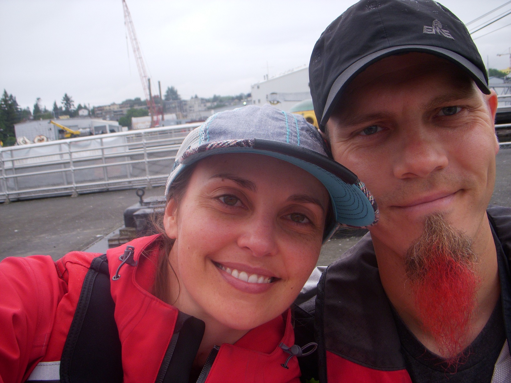
"I can't join you for whatever stupid activity you're planning this weekend cause I'll be out of town for the long holiday weekend," Read the slap-in-the-face-in-email-form glaring at me from my inbox. As the long minutes ticked by, and the sting of rejection slowly lessened to a dull throb, something in that email bubbled to the surface of my consciousness. Long weekend... long holiday weekend! Long holiday weekend? What holiday was it??? A quick search of the Google turned up the fascinating fact that Labor Day Weekend was only about 4 days away! How this knowledge had escaped me until just now is still a bit of a mystery. Upon figuring this out, however, I immediately decided that, first of all, I should definitely not do any laboring on Monday (whew, that was close!) and second of all, we should do an overnight trip in the boat! We've been talking about doing this for a couple of months now, but it's always been difficult. This is partly due to other activities being planned, and partly due to Deb having a dog and a cat that need considerable care, and partly due to bla bla bla and also bla. Whatever, I'm lazy and bad at making things like this happen, ok??? This time, however, Deb's brother was around to take care of the animals, and there were no excuses. So, it was officially time for the first official overnight sailing trip.
With only a couple days to pull this together, I started planning frantically. Where should we go? Did we need to bring the dinghy along? If so, how would we bring it? Tow it behind the boat? Hoist it onto the foredeck somehow? Could we even tow a dinghy through the locks? How far away should our destination be, given that this would be a two day trip? What would I wear?!?!??
After tossing around a few ideas, we settled on Blake Island. Or Bainbridge Island. They are both nearby, and Blake Island is a state park that offers public moorings as well as spots to anchor. Bainbridge has Eagle Harbor with a city dock, places to anchor, and something I had not heard of called a "linear mooring." I looked that up and discovered it was a long cable strung between several buoys, to which you can tie your boat. Having never anchored a boat, I wanted to give myself other, non-anchoring alternatives in case the anchoring didn't go well the first time out.
I dragged out my paper charts only to discover that none of them had a fine enough scale to really see the details of either of the destinations, so I poked around on the NOAA website and downloaded a couple of pdf files of the charts I needed. While doing so, I realized that they also had electronic vector charts available for free download, and I thought, What I need is a handy charting/navigation program to use to display these charts. A quick search revealed a free, open-source nav program called OpenCPN. So I downloaded it, installed the charts, and voila, I could see whatever details I wanted! The only thing missing was a GPS data feed. Now, anyone who knows me can attest to my hatred of electronic navigation whether it be in the car, hiking/biking, flying, or on the water. I've seen too many people turn into drooling morons who just follow the magenta line from place to place, with zero awareness of where they actually are at any given time. When the batteries die, the device falls in the water, loses its signal, or its database is not up to date, they are left in the middle of nowhere, with no idea on where they came from or where they should go. Still, this spiffy nav program with no GPS data was like a car with no tires. Sure, you can sit in it and make engine noises and listen to the radio, but you just kinda feel like you're missing something. Fortunately for me, Fisheries Supply is just a few blocks away, and soon enough I had bought a USB GPS antenna, installed the drivers, and BAM, there was a little red boat sitting right where it should be on the chart! Faaaaannnnn-tastic.
One of my concerns trying to take a boat trip on a holiday weekend was that the locks would be packed with idiots in boats heading out Saturday morning. One of my dock-mates, Fletcher, advised me to head out as early as I could in the morning, just as soon as they started running the drawbridges over the ship canal. This turned out to be 7am. I'm really not an early morning person, but the thought of waiting in line for several hours at the lock was enough to motivate me, so Deb said she'd be down as close to 7 as possible. The weather forecast said 50% chance of rain. Figures, we've had barely a drop of rain all summer, and it's scheduled for the day I want to take the boat out. On the bright side, maybe some of the nautical riff-raff will decide to spend the weekend at home, watching Duck Dynasty or Storage Wars. I got as much stuff prepped on the boat as possible, bought some food for the trip (Deb was bringing the rest), and went to bed.
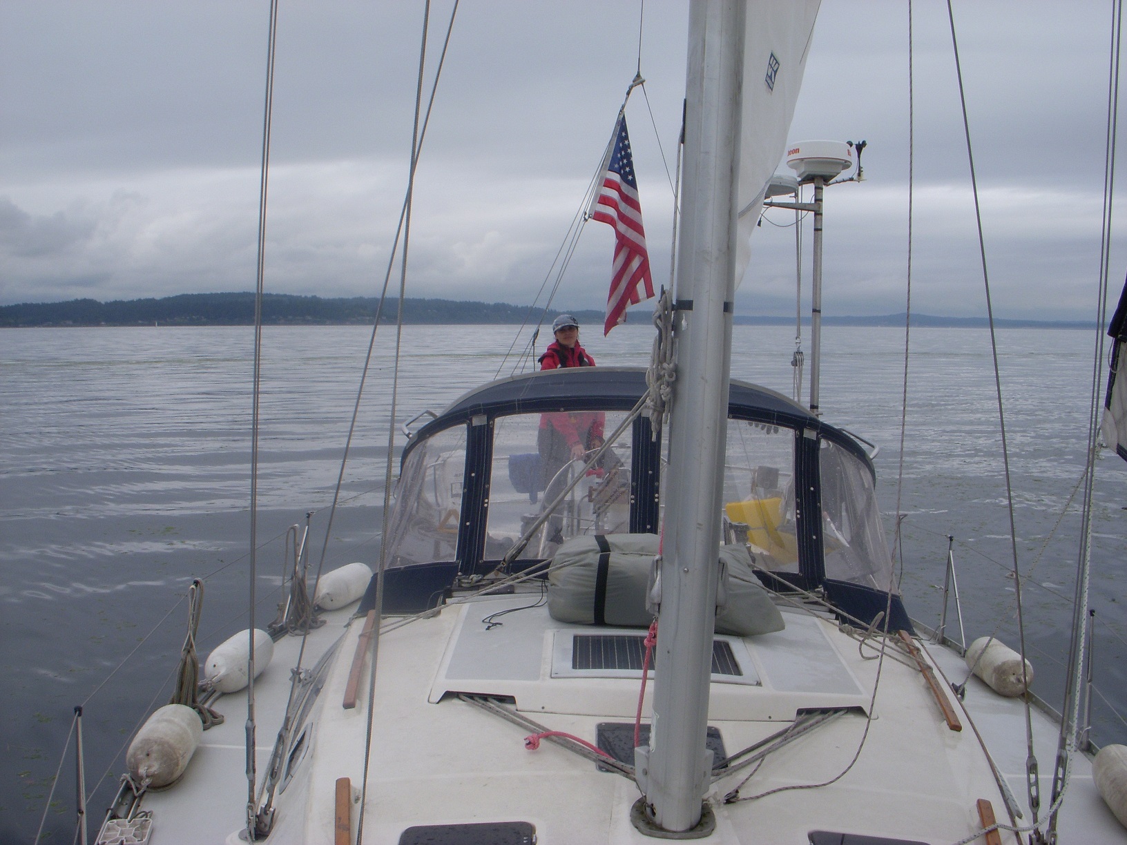
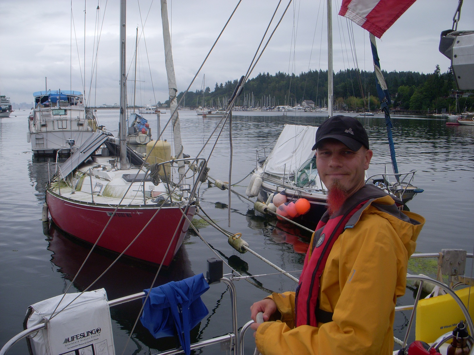
Saturday dawned overcast, and a little drizzly. And REALLY early. Did I mention I don't totally love early mornings? After dragging myself out of bed, I checked the weather again. Wind, 10 knots from the south, chance of rain. Well, at least there would be some wind. After finishing up the rest of the boat preparation, Deb showed up and we got her gear stowed and the food put away. One nice thing about living on your boat is that you never have to worry about what stuff to pack. It's already there. We lashed her inflatable kayak to the deck out of the way. This would be our boat tender for the weekend, since we had no way to lift the dinghy onto the foredeck, and didn't want to deal with towing it. Finally we were ready, started the motor, cast off the dock lines, and we were under way! The time was 8am, a mere hour after our planned departure! Not too bad considering that we usually cast off hours after the time we were aiming for.
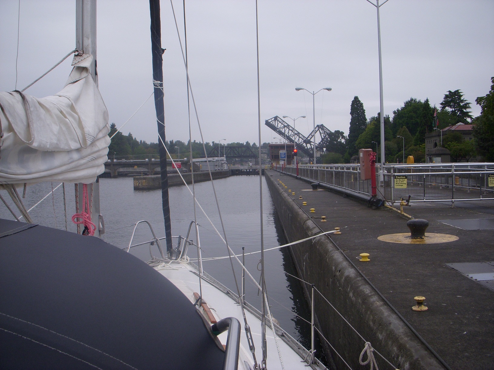
The nearby Fremont bridge opened immediately when we blew the horn. That was possibly the least delay I've had opening a bridge so far. Off to a good start, despite the less than stellar weather. A couple of miles later, and the Ballard bridge opened nearly as quickly. Shortly thereafter, we arrived at the locks, which were currently being lowered. We would have to wait for the next cycle, BUT, we were the only boat there! So we tied up to the waiting wall, and, well, waited. While we waited, we watched some fairly large fish jumping around in the middle of the canal. I have no idea what they actually were, but I'm just going to assume they were salmon. Pretty soon the lock had cycled, and they signaled us in. There was another boat behind us that showed up, and he also fit in, then they closed the doors and down we went. Due to the weather and early hour, the locks were almost completely devoid of spectators, which always makes me feel a little less nervous. Upon exiting the lock, we discovered that the BNSF railroad bridge was already up, so we cruised right under it with no wait. The whole trip out to the sound took maybe half the time it normally would take. All that worrying about crowds, for nothing.
The first stop was Shilshole Bay Marina to get fuel and pump out the holding tank. Normally I'd do this at the fuel dock across from my marina, but they don't open until 8am, and we originally planned to leave at 7. Of course, by the time we left they actually were open, but we decided to just hurry up and get to the Sound, and then deal with that stuff. So we motored into Shilshole, while I ran through a bunch of questions anxiously in my head. Where is the fuel dock here? How high is it? What side should we approach it on? Is the current going to be a factor while docking? (My marina has no current, so I have not had to try and deal with it while docking) I expected a long dock, parallel to the channel in the marina, as that is how the fuel dock here in the lake is. We decided to dock on the starboard side, since we would be coming in the channel with the dock on our starboard side. Not rocket science, really. All the docks there are low to the water, so Deb put the fenders on the starboard side down near water level. Then, we found the fuel dock. It wasn't parallel to the channel at all, it was perpendicular, and you can access it from both sides! So, we went around the far side so that we could dock starboard, only to discover two boats already tied up at the near end, and another small power boat in the process of docking right smack in the middle of the remaining dock area, such that there was not quite room enough for us either in front of him, or behind him.
"Ok, I guess we're going around to the other side..."
"Should I move the fenders over to the other side of the boat?"
"No, we'll just back in or something."
As I got to the other side, I realized this was the perfect time to use the "standing turn" technique, whereby you can spin your boat around within its own length. Having practiced this exactly one time, for about 28 seconds, I felt pretty confident I could perform this in the space between the fuel dock, and the next row of docks. So I motored to the far end of the fuel dock, trying to assess if there was any noticeable current. If there was any, it was slow enough that I couldn't tell. And so, there in the space between these two docks, I executed a perfect in-place 180. Ha, yes!!!! Redemption for some of my previous, horrible, failed attempts to maneuver my boat in its home marina! Despite my boat's prop walk being better suited to port side docking, we made a decent starboard landing at the fuel dock, and tied up. After taking on a whopping 4 gallons of diesel (this boat is more fuel efficient than I expected), we walked it forward to the pump out and emptied the holding tank, and then went to use the bathroom ourselves.
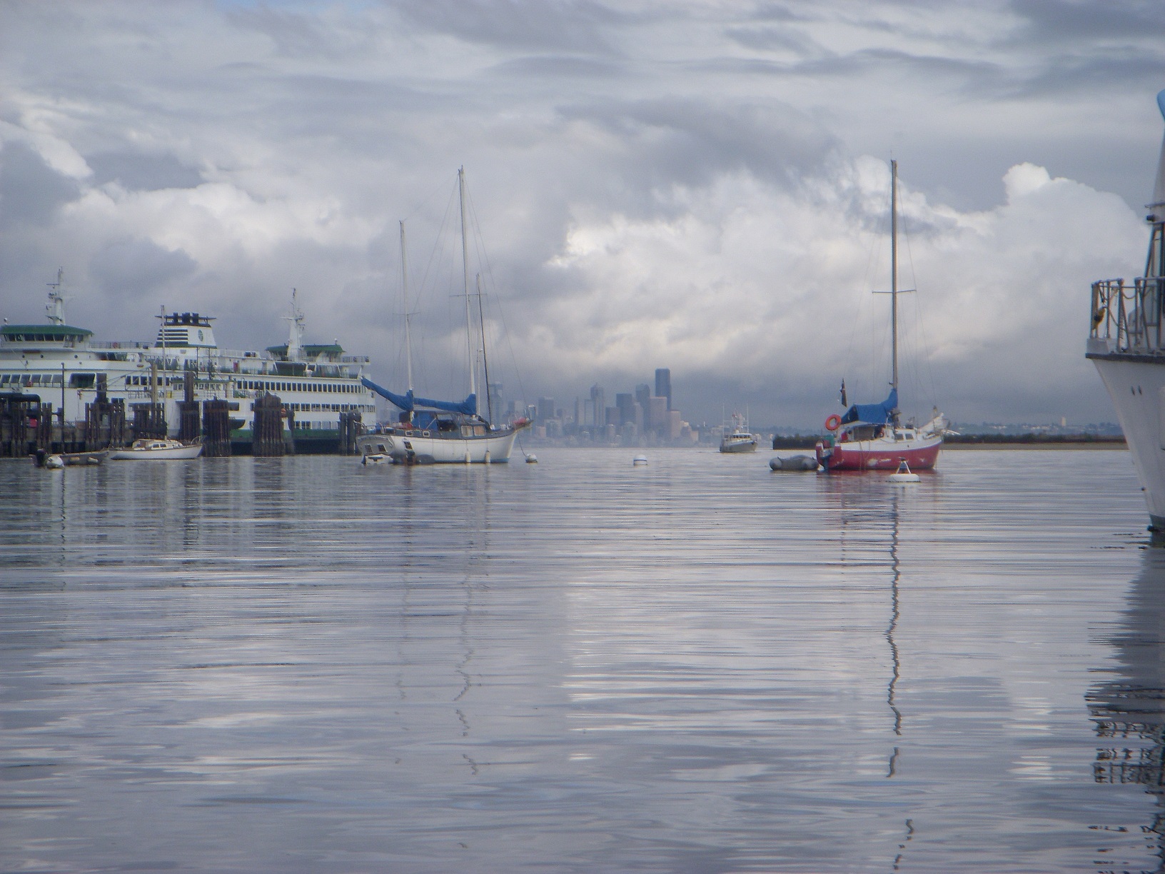
Upon returning to the boat, I looked out over the water and realized that it was pretty difficult to see Bainbridge Island across the water with the light rain reducing visibility. Bainbridge runs north-south parallel to the Seattle waterfront and to the West with about 4 miles of water in between. Eagle Harbor, our chosen destination, is on Bainbridge about 4 miles south of Shilshole. Blake Island is small, just off Bainbridge, but farther South, approximately 8 miles away (Yeah, I know, we're really following in the footsteps of great nautical explorers of the past, striking out for exotic locations at the far edges of the map. Whatever, baby steps.) I had a very brief moment where I thought about scrapping the trip due to barely being able to see land only 4 miles away. Then I thought, Wait a minute, I have not one, but TWO forms of GPS on board, I don't need to see anything, we're good to go! Never-mind the fact that one is an untested program on my laptop, and the other is a handheld whose "map" consists of only the waypoints that I have programmed in, and no chart data of any kind. I did have a compass, a backup compass, and rudimentary knowledge of what heading to sail to reach Eagle Harbor... so, what could possibly go wrong?
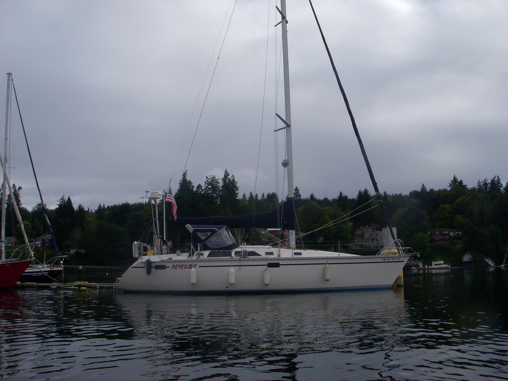
With the reduced visibility combined with the fact that we were going to be crossing an often busy shipping lane, and then entering a harbor with large ferry boats entering and exiting, it seemed prudent to use The Radar. Lots of boats have radar. They integrate with fancy chart plotters so that you can overlay radar data with chart and GPS data, and even wind speed and direction, and maybe output a signal to the boat's autopilot to steer the course you have programmed in. Fancy! Aboard Renegade, not so much. My radar is old. It has a monochrome CRT display. Remember those? Back before flat screens, when your TV was shaped like a BOX? That's what this is and it doesn't integrate with ANYTHING, not that I have much for it to integrate with anyway. I dragged it out and attached it to its mount in the companionway so that it was visible from the cockpit, and turned it on to let it warm up. Meanwhile, we cast off the lines again, and we were on our way!
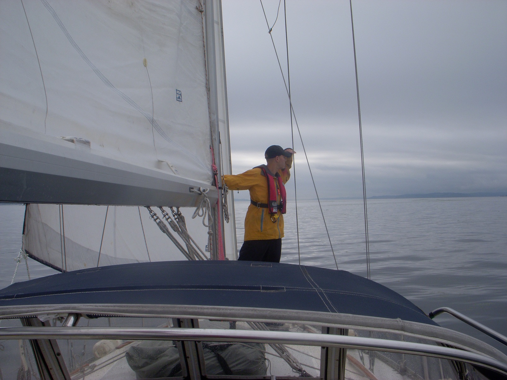
Once out of the marina, there was some wind so we put up the sails and killed the motor. It wasn't the predicted 10 knots by any stretch, but it was out of the South, and it was enough that we could cruise along at a relaxed 3 to 3.5 knots. The rain was intermittent and light, and visibility seemed to be improving. All in all, not too shabby! With Deb at the helm I occupied myself playing with the radar. It has a lot of analog adjustment knobs for Gain, Tune, Sea Clutter, Rain Clutter, and other similar stuff. I'm not really sure exactly what any of them do, but I twiddled them until I got the best picture possible, then started trying to correlate things I saw on the screen with visible boats and land. This was a bit harder than one might think, and I'm glad I was actually able to see stuff that was out there.
After some time, we had sailed approximately two thirds of the way to entrance of Eagle Harbor. We passed one of the buoys that marks a segment of the shipping lane, and continued on. With the wind from the South, and our destination to the South-West, we were able to do most of this journey on port tack, sailing more or less directly towards our destination. Then, with the shipping channel marker a quarter mile or so behind us, the wind got light. Let me rephrase that: the wind started out light, and now it was lighter. My first thought was that maybe the wind was stronger out in the middle of the water, and died down a bit closer to land, so we tacked over, and now headed South-East, back towards the middle, and the shipping lanes. Unfortunately, it did nothing to boost our now very light wind. It soon became apparent that we were experiencing a phenomenon that seems to haunt me almost every time I go sailing. This is something I have termed, The Law Of Proportional Winds, and it works like this: when you are trying to sail someplace, the wind is proportional to the remaining distance. So the closer you get, the less wind there is, and you seem to never be able to quite get where you are going, even though it's just right over there and not 20 minutes ago you had plenty of wind.
As we got slower and slower, another factor came into play: the current. You see, that too, like the wind, was out of the South, and therefore working against us. It was only a half knot or so, but at this point we were only moving about 1 - 1.5 knots through the water, and that was at a 45 degree angle to the direction to which we need to make progress: due South. In a world with no current, sailing upwind as we were, our path would zig-zag back and forth, 45 degrees on either side of the wind. But with the current being a factor, we were losing most of the progress that we were making. In fact, the cold, mathematical truth of the GPS showed that our track over the ground was nearly perpendicular to the direction we were trying to go. At one point, I looked behind us and the shipping lane marker to our North was actually getting closer rather than farther away!
You may be thinking to yourself, or perhaps saying out loud, "Why don't ya just start the motor up? I mean, I know ya gots one, cause I seen ya talkin about it up there, back further at th'other part of the story. See, if ya just turn that on, you'dda been there by now!" Well, sure. But if I wanted to motor around, I would have bought a trawler or a Bayliner or something silly like that. And if I had really wanted to get there quickly, I'd have just taken the ferry. But that's not the point. This is a sailboat, and the point is to sail. So we continued to sail, and after a half hour or so of utter futility, the "wind" shifted a bit in a direction that allowed us to sail more directly to where we wanted to go. This was enough (barely) to put us ahead of the current again, and we very slowly started making progress to the South. We gained back the ground we had lost, and then a bit more. And a little bit more. We clawed our way along yard by yard, until we were nearly as far South as the harbor entrance channel, and a half mile or so out. All that was left was to stay on the heading we were on and slowly drift our way West towards shore, and a little more to the South.
And then, the wind died completely.
Whelp, time to start the ol' motor! I mean, let's be serious here, once we got near the mouth of the channel we were going to start it and drop the sails anyway, it's not like I'm going to try and sail into this harbor I've never been to before... who does that??? At some point I will, when I have a better idea of what I'm doing, and more dependable wind, but not just yet. I fired up the motor, furled the headsail, and then Deb and I dropped the main. Renegade has a "Dutchman" flaking system which is in theory supposed to allow you to just drop the sail, and it will fold itself neatly back and forth across the boom. In practice, seems to work about 80% correctly, about 90% of the time. The rest of the time, you have to kinda coax the sail a bit to so that the folds lay straight, and it's evenly draped across both sides of the boom. Once the sail was down, I decided to open 'er up while Deb straightened out the sail.
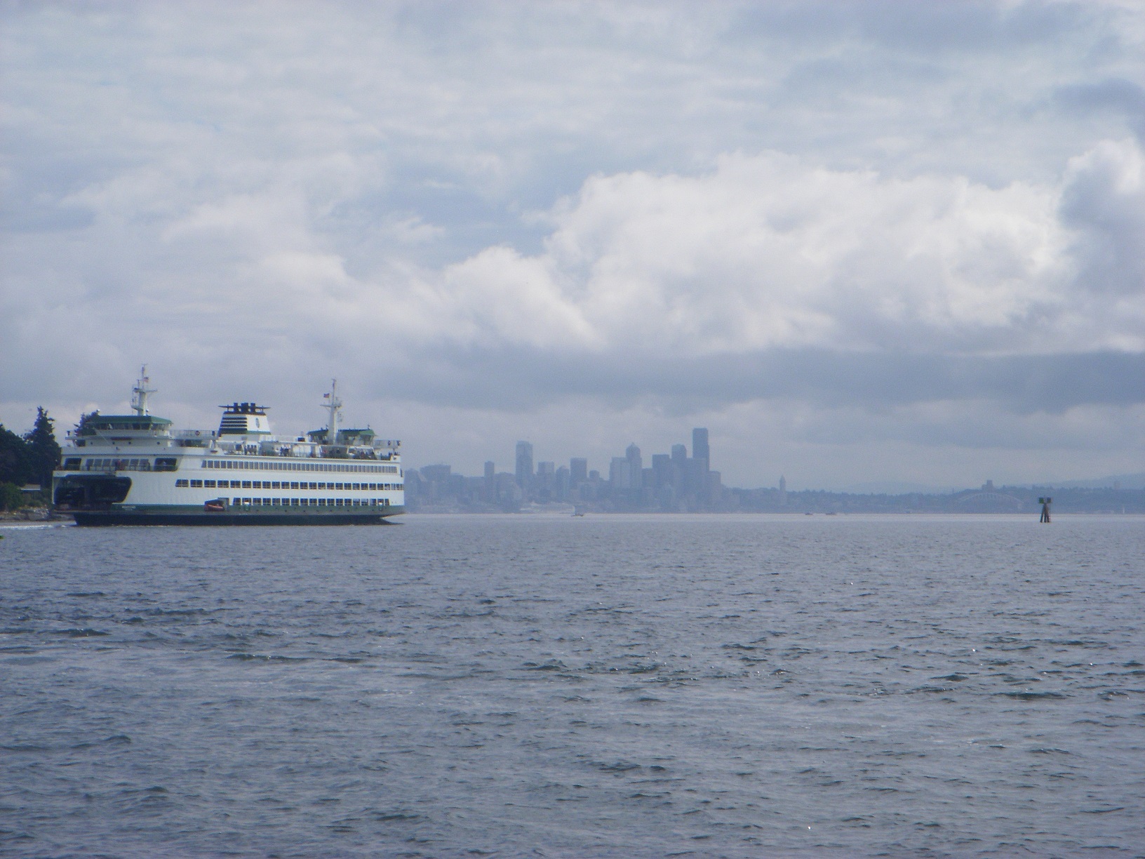
With the diesel spooled up, and the boat moving at cruising speed of 6.5 knots, Deb needed a little assistance with the aft part of the sail, so I left the wheel to go help. Unfortunately I spaced out and neglected to remember that the prop wash tends to grab the rudder and yank it to one side when moving at that speed. I made it about 3 steps before the rudder turned to full lock and the boat began a hard turn which I'll just refer to as a "death spiral." By the time I grabbed the wheel and straightened it out, we had veered well more than 90 degrees off course in a matter of a couple seconds. I guided her back onto her original heading while Deb took a break from flaking the sail to make fun of me. She's mean, I tell you, mean! With that epic fail sorted out, we made quick progress into the channel. The chart showed things getting pretty shallow of the right side of the channel. And sure enough, as I got over there, the depth sounder went from 30 down to 20 and then 16 feet in short order, and I was still within the marked channel. No sooner had I decided that I should move back out towards the center of the channel a little, when the ferry rounds the corner coming the other direction. The ferries are big, and fast, and one of them recently ran into, and sunk, a sailboat that happens to belong to a buddy's father-in-law. With that thought in mind, I headed back as close as I dared to the right side of the channel, so that he had plenty of room to pass. Oddly enough, for a boat that large and fast, the ferry produces very little wake. So as soon as it was past, I headed back out into the middle of the channel.
That's when things got "exciting." As I motored into the flat, smooth water that the ferry left in its path, Renegade was suddenly tossed around like a chew toy by a large dog. We were rolled violently from side to side, and turned left or right seemingly at random. It took me about half a second to figure out what was going on; we were caught in the turbulent prop-wash from the ferry. Although the surface of the water looked smooth and flat, underneath was a roiling, seething mess of vortexes and currents, and we had a big vertical fin stuck right down into the middle of it. There was nothing much to do but ride it out, and that's what we did. After what seemed like 8 minutes, but was probably closer to 8 seconds, we found ourselves in calm water, no worse for wear.
"Huh. Let's not do that again."
With no additional surprises, we located the city dock, which turned out to be full. The linear mooring was also easy to locate, and had some space left on it, so we decided to tie up to that. We got alongside it no problem, and Deb snagged the heavy mooring line with the boat hook, but the actual challenge on this thing turned out to be simply tying up to it. The heavy line which was strung between buoys was about a foot off the water, and had floats and rings attached every 15 feet or so. The idea was to tie our bow and stern line to a couple of those rings. The problem is that the deck of my boat is 4 feet off the water, and except right in the middle, the side of the boat is not right up against the line. After getting a mid-ship line tied off, this involved a somewhat frustrating process of trying to toss a line over the rope near a ring, then sticking the boat hook through the ring, trying to snag the line, and pull it back through. Eventually this worked, and we tied ourselves up securely and finally had a chance to look around a little bit.
Eagle Harbor is a very neat little place, somewhat long and skinny running East-West. Looking out to the East back through the channel, you can see downtown Seattle in the distance. On the North side is the city dock, several marinas, and the small town there. Just to the East of that and around the bend is the ferry dock. To the South is mostly what seems to be private residences. The harbor itself has a variety of boats either anchored or tied up to permanent moorings. I don't know for certain, but I think most if not all of those moorings are private. It's very quiet and peaceful, and seems to be quite well sheltered. The whole area had a sleepy feel to it, and reminded me in some way of every movie I've seen where someone gets temporarily waylaid in a small town and is told that, "Things move slower here sonny, the radiator hose you need will be in next week, or mebbee week after... all depends when the delivery truck comes through."
With the boat secure, Deb and I inflated the kayak on the deck, and got it in the water. It's a tandem kayak, but she only has one paddle. When you use the paddle normal kayak style, the end out of the water drips water onto your leg because it has no deck like a traditional kayak. We've determined that the best way for the two of us to paddle it is to separate the paddle into its two halves, and each use one like a canoe paddle. One of the nice features of Renegade is the swim platform and ladder on the transom, which makes getting into a kayak or dinghy pretty easy. The city dock has a section just for dinghies, so we paddled over and tied up. I found the drop box, deposited $10 for our overnight stay, and we headed back to the boat.
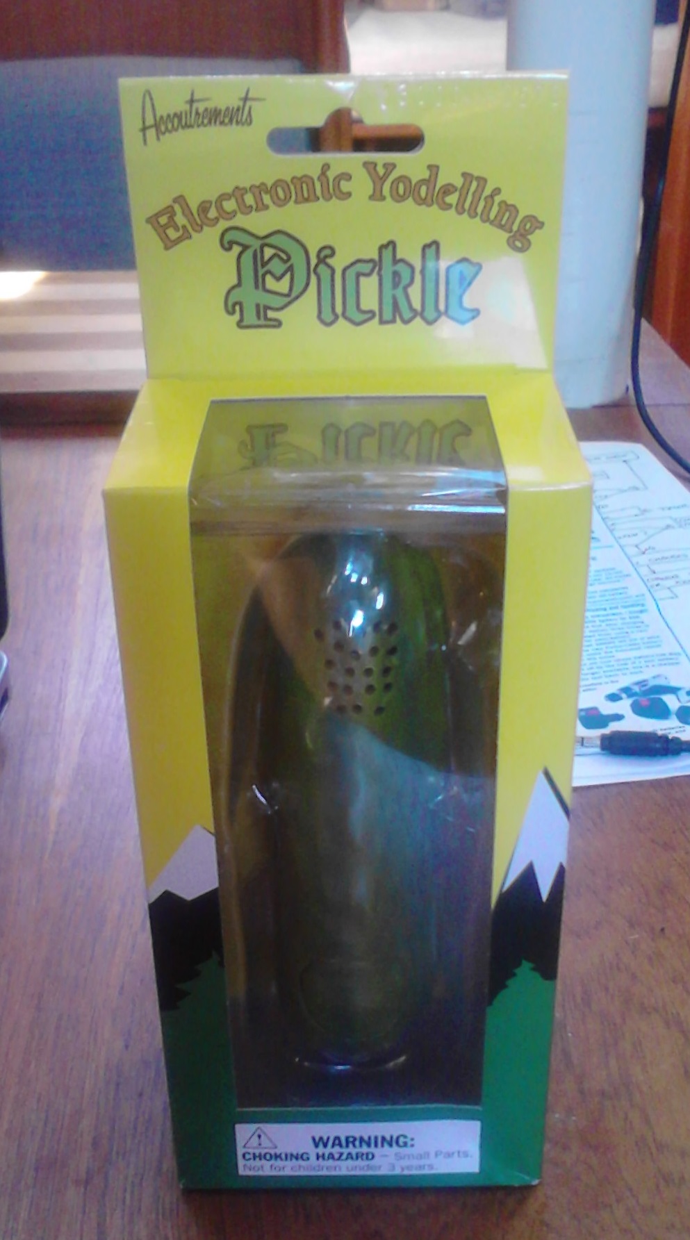
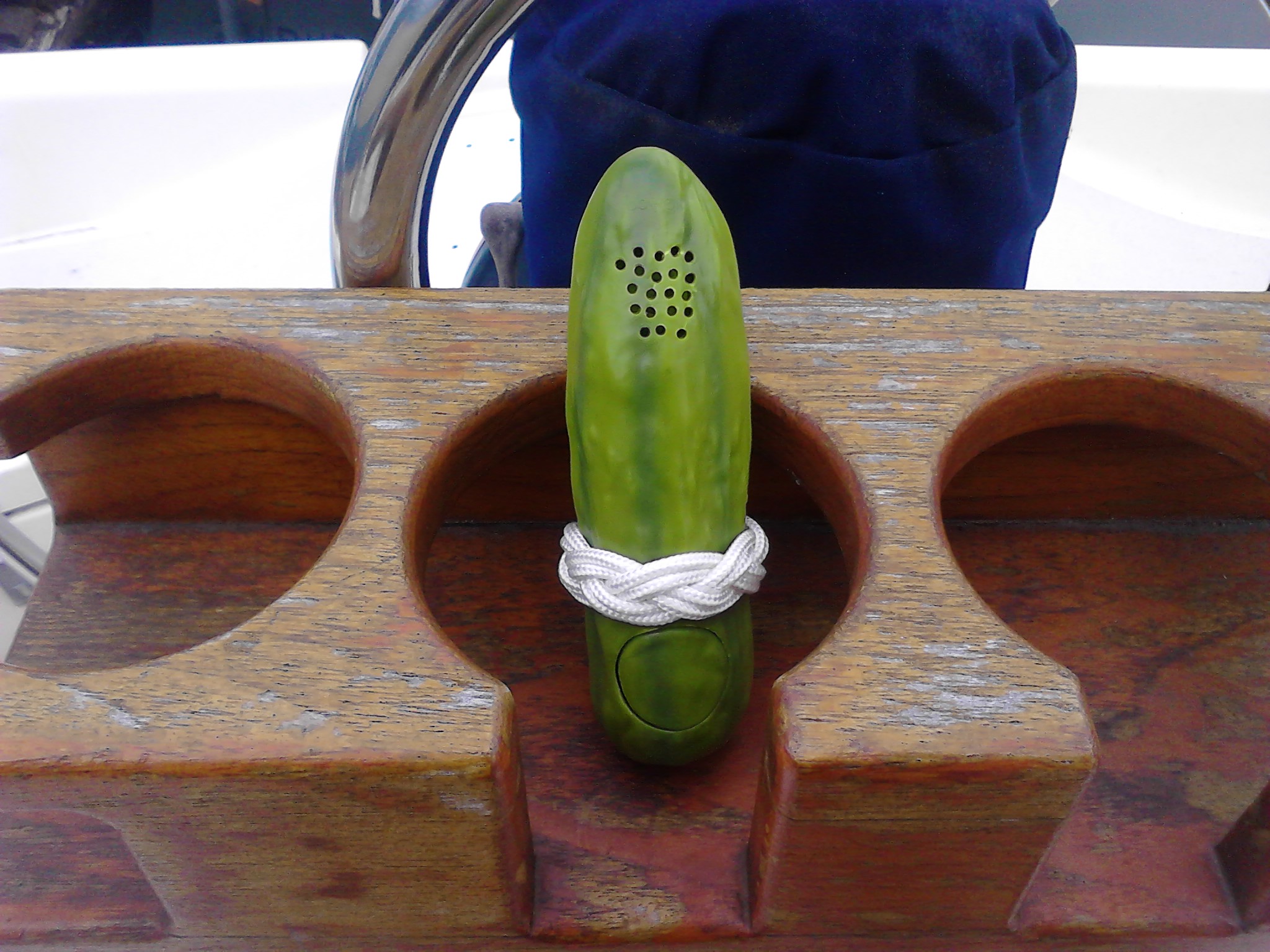
It was now after 3pm, and the last time we had eaten was around 7am, so lunch was in order. We made grilled portabella mushroom sandwiches, ate, cleaned up, and decided to go explore the town. The town probably has a name, but I don't know what it is, so I'll just call it, The Town. The Town is a quaint little place with cool little shops and restaurants. We wandered into the first coffee shop/bakery we saw, and got coffee and cookies. I mean, it had been almost 30 minutes since we ate! Our next stop was a toy and game store. It was in this store that I found one of the highlights of the entire weekend: and Electronic Yodeling Pickle! The name pretty much says it all, it's an electronic pickle, and when you press a button it yodels. Genius! I managed to resist the urge to purchase it, and we went on our way. We found a cool outdoor gear store and I tried on a couple of backpacks, then we went to the grocery store to get some additional items for dinner, and paddled back to the boat in the rain. Of course I didn't have any rain gear, because it was not raining when we left the boat.
Dinner was grilled salmon and broiled potatoes, which we ate out on the deck at the cockpit table. It was fairly dark at this point, and I do not have any lights in the cockpit. Eating by headlamp seemed a wee bit lame, so I went in search of a candle or something. I have a pretty snazzy little candle lantern that I use for camping, and I searched every locker and space on the boat for it, but to no avail; it must be in my storage unit with the rest of my camping gear. However, I did find one of my "apocalypse emergency candles." I made these one day when I was bored and prepping for the Zombie Apocalypse. It consists of an empty tuna can filled entirely with cardboard rolled up like a cinnabon. Then the whole thing is filled with melted wax and allowed to set up. Ostensibly you just light the top of it, and it's like a candle that's nearly all wick, so you get a nice big flame for cooking or whatever. I set one on a wooden cutting board on the cockpit table, and attempted to light it. It was a little bit like trying to light a piece of firewood directly with a match as there was so much mass to get up to burning temperature. Each time I got a small amount lit, the breeze would blow it out again. After several minutes of effort, with Deb looking on skeptically, I got enough of it burning that it was self-sustaining, and I triumphantly began eating. The candle continued to light more and more of its own wick as it gained strength, and within a couple minutes we had a miniature raging bonfire blazing away on the table next to us. The flame was a good 7 inches tall and danced around wildly in the wind like a naive co-ed at a frat party who's had a couple too many glasses of something made out of Keystone Light, cheap vodka, and pink lemonade concentrate. "Who wants to do shots????" There's your tuition dollars hard at work, Mom and Dad!
As I entertained visions of burning my boat down to the waterline, Deb and I came to the conclusion that the Apocalypse Emergency Candle was perhaps a little too hard-core for the romantic dinner environment, and I put it out under a bowl. Once out, it was replaced with the oil lamp that hangs above the table in the saloon, which, it turns out, is removable and has a glass chimney to shield it from the wind. With mood lighting sorted, dinner continued uneventfully. We rounded out the evening with a game of Bananagrams, the official "board" game aboard Renegade.
During the night I had to use the bathroom. I was delighted to find that the sea water, drawn in to flush the head, had little flecks of bio-luminescent algae or something, which made glow in the dark streaks down the inside of the bowl! This more or less offset my annoyance at having peed all over the floor in the dark.
Sunday dawned a bit overcast, and with blueberry pancakes. Okay, the pancakes didn't just arrive just cause it was Sunday; I had to make them. None the less, they were quite tasty, and a pretty good start to the day.
"Maybe we should go back into town before we head out," I suggested casually.
"What? Why?"
"Ohh, um, well, in case there's any cool shops that we missed."
"We didn't miss anything..."
"I need to buy the yodeling pickle, okay???"
"NO, we are not going back into town for that; what are you going to do with a yodeling pickle anyway????"
"Fine...."
So instead of going back into town, we readied the boat for departure, fired up the motor, and cast off. As we neared the ferry dock, the ferry was just departing. Having learned my lesson the day before, I stopped and waited and let it get a good distance out before I dropped in behind it and followed it out through the channel to open water. Once clear of the channel, we hoisted the sails and pointed the boat towards home. The wind and current were both from the South again, only this time we were heading North, so everything was in our favor. The wind was light, like the day before, but we were able to glide along and 3 knots or so. The sun came out and burned off the morning clouds, and everything was dandy. Before long, we spotted several dolphins a couple hundred feet away, swimming lazily along behind us. Had we been moving a bit faster, perhaps they would have come over to ride our bow wave, but it was still cool to see them!
As we sailed home, I realized the only thing we hadn't done yet was try anchoring the boat. I had meant to do that in the harbor, but forgot all about it. Deb and I talked about it and decided maybe we could practice it somewhere over by Shilshole. She had taken a sailing class there, and they practiced anchoring someplace nearby. After some discussion, it turned out they had anchored in the canal itself, just to the outside of the channel. While that probably was OK back in February when she took the class and there was no boat traffic to speak of, at this time of year that area is very busy with boats waiting to go into the locks, people fishing, etc. I decided instead to anchor in front of the Shilshole break-wall. The race committee boat anchors there for the start/finish line during weeknight races, so I figured that was a likely spot.
As we got closer, the shallow depth alarm started going crazy, and the depth finder indicated only about 5 feet of water! My first thought was that we were about to run aground on some rocks or something. After a little consideration however, I realized that we were in an area that is several hundred feet deep. The shallow depth continued for a minute or so and then gradually got deeper, and eventually started showing realistic readings again. I have no idea what it was... maybe a whale, submarine, school of fish, or some weeds caught on the boat? Who knows. I'll just assume it was a whale shaped submarine covered in weeds.
Arriving at Shilshole, we dropped the sails and started the motor and began looking for a place to anchor. Unfortunately the entire area in front of the break-wall was covered in little buoys marking crab pots. There was a traffic lane of sorts between the crab pots and the break-wall, but I didn't want to block the way for other boats that needed to go through there. I was also worried that being so close to the wall, the current or wind might swing me into it! Eventually we just decided to scrap the anchoring and do it next time we went out to someplace. With that out of the way, we headed into the ship canal.
After a little bit of a wait for the railroad bridge to open, we crossed to the upstream side between the bridge and the locks, and tied up to the waiting wall there to wait for the locks. Another wait, and then the locks opened and we were fourth in line. We should have been first, as the locks serve boats in the order that they arrive. However, we were stuck downstream of the railroad bridge, while a couple power boats and a smaller sailboat went past and tied up at the wall. They should have let us go first into the locks, but didn't. It ended up not being an issue because we all made it in together, and while we were waiting for the water to raise, the skipper in front of me apologized for cutting in line.
Unlike our trip out, it was mid afternoon, and a nice sunny day, so the lock walls were crowded with spectators. I'm not a huge fan of this, although I'll be the first in line to watch someone else's lock-traversal disaster any day of the week. All went well though with no mistakes locking through, and soon we were on our way again. Ballard bridge... Fremont bridge, and an uneventful docking back at the marina. We tied the boat up, put everything away, and went and grabbed a late lunch nearby to finish our trip.
All in all, it was great fun, and I can't wait for the next one. Hopefully it'll be farther, longer, and I'll get to try anchoring.
The other day I was walking past our local novelty toy shop, Archie McPhee's. On a whim I stopped in, and sure enough, they had Electronic Yodeling Pickles! I bought one without hesitation, added some decorative ropework and now have an official Yodeling Pickle for the boat.